
Sri Lanka occupies a unique position in the Indian Ocean, at the southeastern tip of India. This island, covering 65,610 km², roughly the size of Ireland, stretches 435 kilometers from north to south, with a coastline of 1,340 km. Understanding its precise location also means grasping why this country concentrates so many peculiarities in such a compact territory.
Geographical Coordinates and Tectonic Positioning of Sri Lanka
Sri Lanka is located between latitudes 5°55′ and 9°51′ North, and longitudes 79°41′ and 81°53′ East. The Palk Strait, about thirty kilometers wide, separates it from the Indian subcontinent. This shallow arm of the sea is home to Adam’s Bridge, a chain of limestone shoals that almost physically connects the two territories.
You may also like : Discover the salary scale for heavy truck drivers in Switzerland based on experience and canton
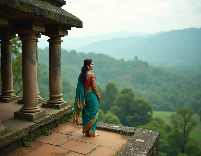
The interior landscape contrasts sharply with the beach image that many associate with the country. The central massif peaks at Pidurutalagala at 2,524 meters above sea level, and it is in these high plateaus that the tea plantations that have made Ceylon’s reputation are concentrated. The coastal plains, on the other hand, quickly descend to sea level, creating very distinct microclimates between the arid north and the southwest exposed to the monsoon.
To visualize precisely where Sri Lanka is located on the world map, one must look just below the tip of the Indian subcontinent, slightly shifted to the east. This position makes it a historical maritime crossroads between Southeast Asia, the Middle East, and East Africa.
Recommended read : Discover the richness of Malagasy culture through videos, music, and news
Language Status in Sri Lanka: An Overlooked Constitutional Nuance
Most travel guides vaguely mention that Sinhala and Tamil are spoken in Sri Lanka. The legal reality is more nuanced. Both Sinhala and Tamil are official languages, while English has a distinct constitutional status as the “language of communication” of the State.
This distinction has direct practical consequences for travelers. English is neither an official language in the strict sense nor merely a foreign language. It serves as an administrative and commercial vehicle, particularly in Colombo and tourist areas. In rural regions of the north or interior, communication is almost exclusively in Sinhala (spoken by about 74% of the population) or Tamil (about 18%).
We observe that this linguistic distribution directly reflects the geography of the country. Tamil speakers are concentrated in the northern and eastern provinces, while Sinhala dominates the rest of the island. This linguistic mosaic also shapes the tourist offer: tours in the Cultural Triangle (Dambulla, Sigiriya) take place in predominantly Sinhala areas, while Jaffna and the northern peninsula offer a very different Tamil immersion.
Climate and Monsoons: Two Coasts, Two Opposite Seasons
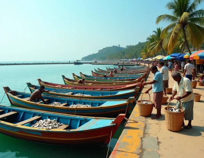
Sri Lanka experiences two distinct monsoon regimes depending on the coast, which constitutes its main climatic peculiarity. The southwest monsoon (Yala) hits the west coast and the highlands from May to September. The northeast monsoon (Maha) affects the east coast and the north from October to January.
This reversed system means that there is always a part of the island in the dry season. Savvy travelers take advantage of this shift:
- From December to March, the south and west coast (Galle, Bentota, Mirissa) offer the best conditions for beaches and whale watching
- From May to September, the east coast (Trincomalee, Arugam Bay) takes over with calm waters and quality surfing
- The highlands around Ella and Haputale remain accessible most of the year, with cool temperatures that drop significantly at night
Pidurutalagala and areas at altitudes above 1,500 meters receive abundant rainfall year-round. It is precisely this constant humidity that allows for tea cultivation at these altitudes.
Recent Political Context and Practical Access from France
Sri Lanka has experienced notable political alternation with the election of President Anura Kumara Dissanayake in September 2024. The country operates under a presidential republic regime, with a dual capital: Sri Jayawardenepura Kotte for administrative functions and Colombo as the economic center. Prime Minister Harini Amarasuriya has been in office since September 2024.
This two-capital configuration often surprises. Colombo houses the international airport (Bandaranaike), operational embassies, and commercial activity. Sri Jayawardenepura Kotte, in the suburbs of Colombo, is home to Parliament and official institutions. In practice, the two cities form a single urban area.
Time Zone and Difference with France
Sri Lanka is in UTC+5:30, an atypical time zone shared with India. The time difference with metropolitan France varies between 3h30 (summer time) and 4h30 (winter time). This rare half-hour time zone reflects the historical and geographical proximity to the Indian subcontinent.
Population Density and Territorial Organization
With 338 inhabitants per square kilometer, Sri Lanka is among the most densely populated countries in Asia. The territory is divided into 9 provinces and 25 districts. This density explains why national parks (Yala, Udawalawe, Wilpattu) play a role as ecological lungs on an island where natural space is under constant pressure.
- Buddhism accounts for about 70% of the population, Hinduism 13%, and Islam 10%
- The main cities after Colombo are Dehiwala-Mount Lavinia, Moratuwa, and Kandy
- The telephone code is +94, and the internet domain is .lk
The local currency, the Sri Lankan rupee (LKR), has experienced significant fluctuations in recent years. We recommend checking the exchange rate shortly before departure, as variations can significantly affect the daily budget on-site. The country remains a destination with a favorable value-for-money ratio compared to its Southeast Asian neighbors, but the actual cost heavily depends on the type of tour chosen and the season.